


You are here
Home »
Directory of Gudauri »
BACKCOUNTRY SKIING IN GUDAURI & Kazbegi »
SUMMER | Rafting and kayaking near Gudauri »
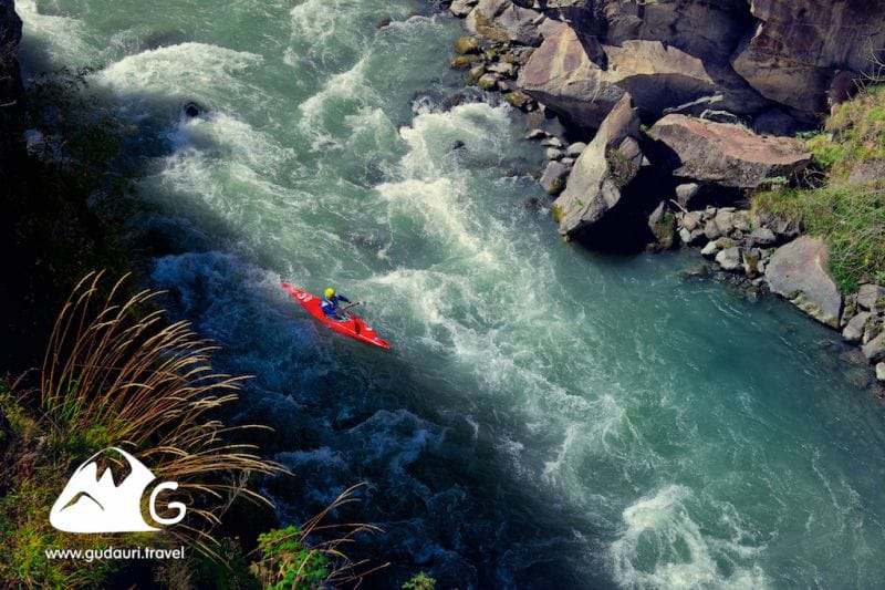
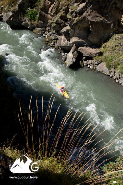
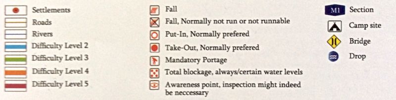
Kayaking, Pshavi Aragvi, M1
Kayaking, Pshavi Aragvi, M1

Contact details
Mamuka
+995 599 141 160
Вид активности
Kayaking
River
Pshavi Aragvi
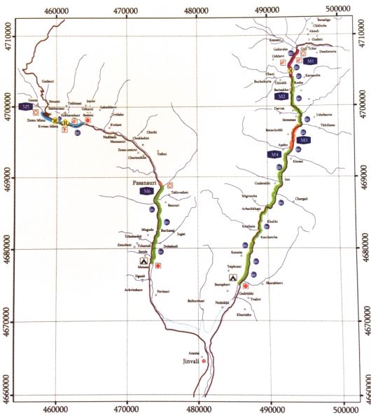
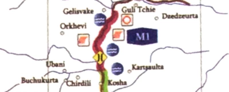
Map Section
M1
Difficulty Level
April - June: 4-4,5
July - August: 3-3,5
September - October 3
July - August: 3-3,5
September - October 3
Best period
April - October
Duration of the run (Min)
30-40 мин.
Description of the route
Is the most difficult one and is classified between 4-4.5 categories. As beginning this section is a waterfall to be seen, which height is 3 meters. The difficult part continues 5km along. It’s impossible to explore the river before descending, which increases the category of difficulty to the 5th category. There is some risks of being blocked by trees. This section ends as the valley ends, where is located a bridge. The next 5 kilometer the river flows in broad valley.
Start Place
Valley of Borisakho
GPS сoordinates of the starting point (Latitude / Longitude)
42.52735809 / 44.93590191
Сoordinates of the finish point (Latitude / Longitude)
42.50578148 / 44.92346182
Additional Information
Aragvi river located in eastern Georgia – Kazbegi, Dusheti and Mtskheta municipalities - its length is 112 km, the catchment area is 2724 square km. Aragvi system of rivers made by - Mtiuleti (White) Aragvi, Gudamakari (Black) Aragvi, Khevsureti Aragvi and Pshavi Aragvi. The Main Aragvi starts in north - eastern part of volcanic mountains. Aragvi at upper and middle reaches is the mountain river, the lower section which flows at Mukhrani and Mtskheta plains apart. After it crosses the mountain range Skhaltba and Saguramo. Attached to the left side of the Mtkvari in Mtskheta.
Aragvi fed by groundwater, rain and snow, as well as Glacier and eternal snow water.
Aragvi fed by groundwater, rain and snow, as well as Glacier and eternal snow water.
